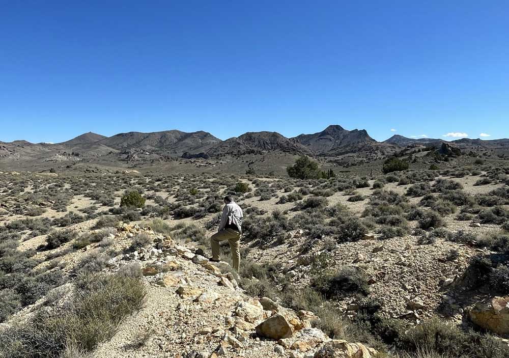
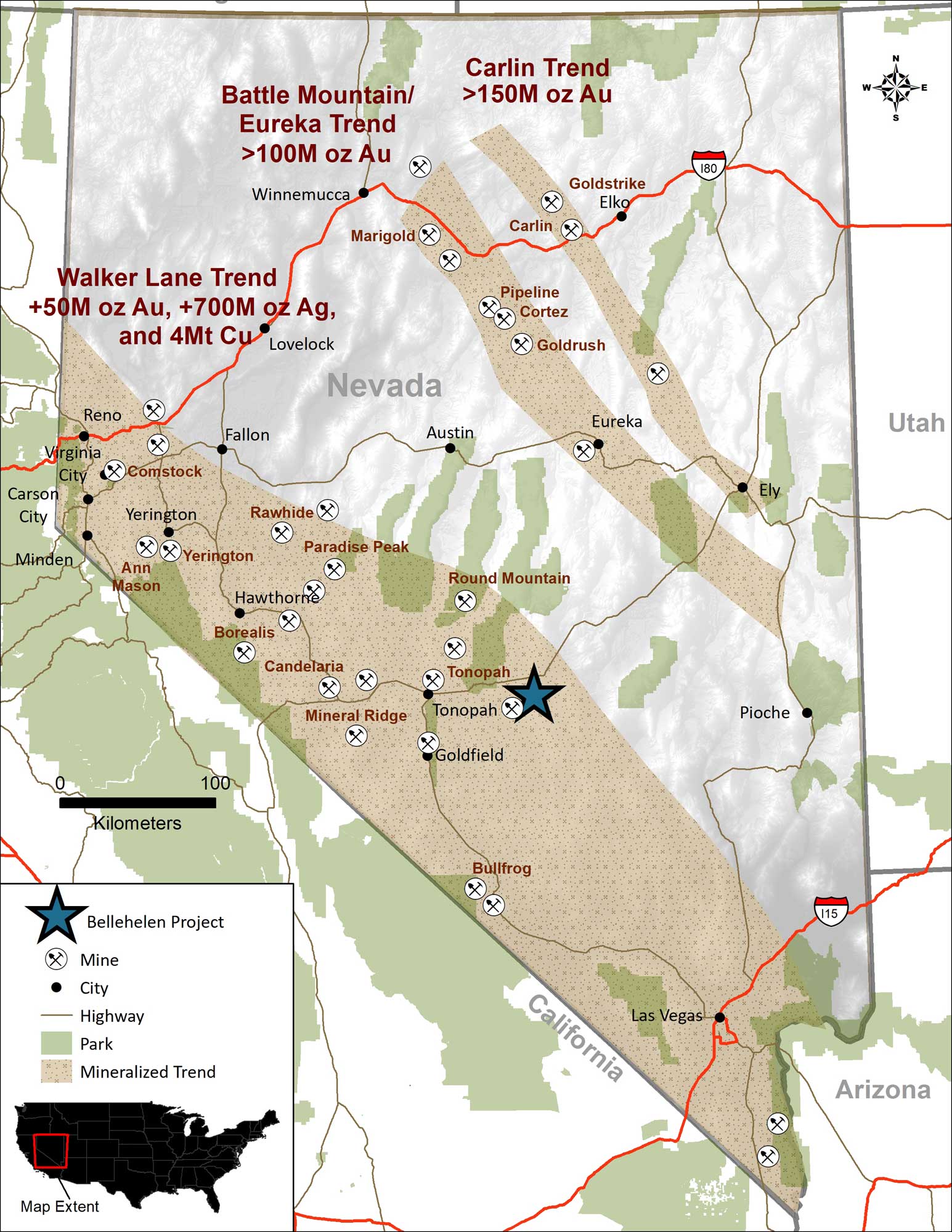
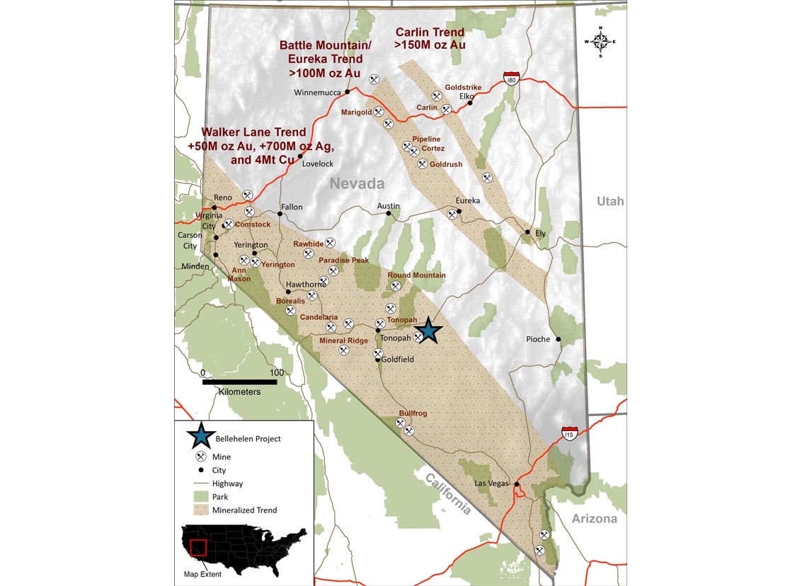
The Bellehelen Mining District lies along the Kawich-Toiyabe (KT) Lineament, a 100 km long west-northwest structural trend extending from the Reveille Range east of the Property to the Monitor Valley, east of Tonopah, Nevada. This KT Lineament is a significant focus for precious metal mineralization in Central Nevada.
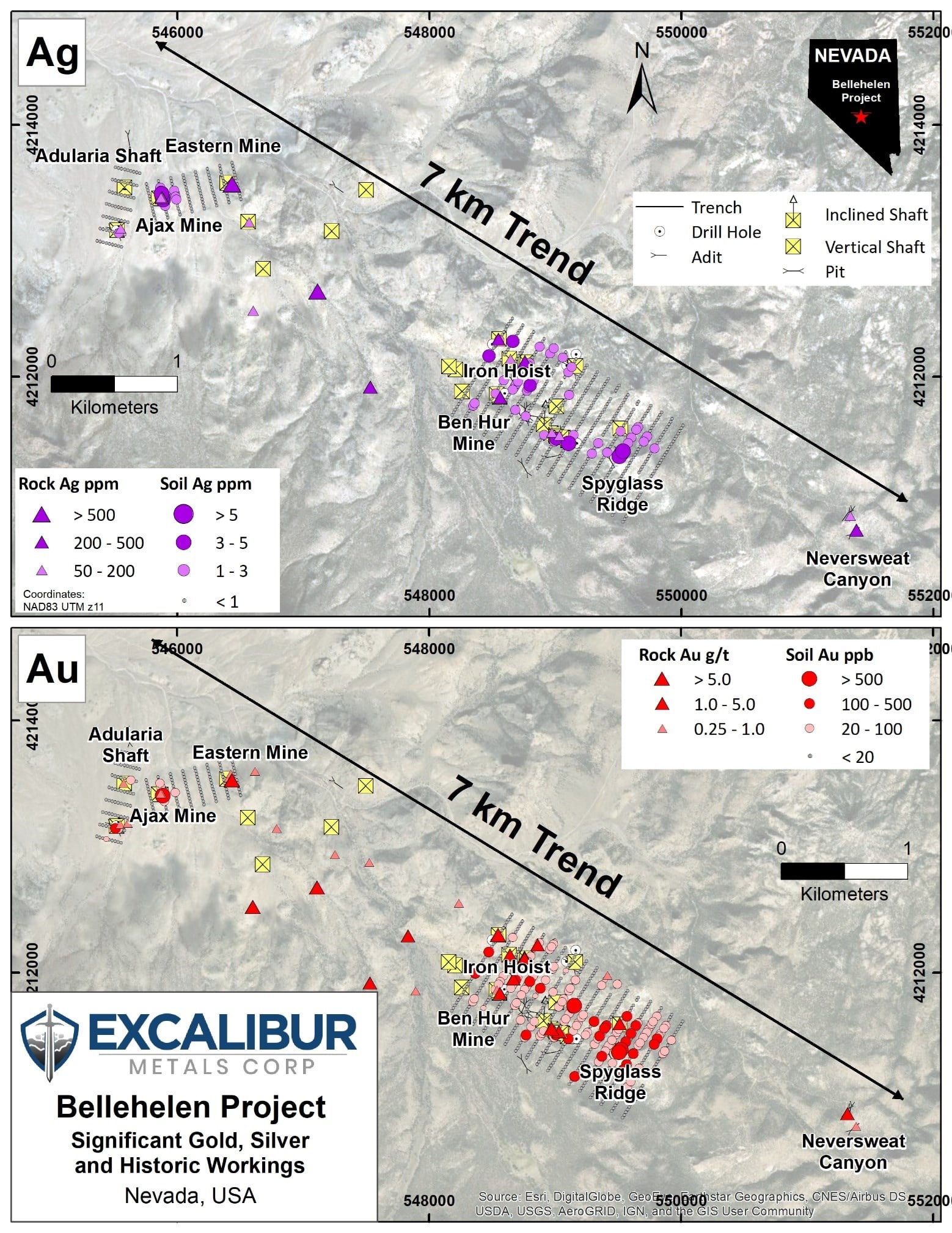
The Project area is underlain by early Miocene rhyolitic ash flow tuff and megabreccia deposited in the Bellehelen Caldera centred the Bellehelen Fault Zone. Mineralization likely occurred following crater-collapse driven by hydrothermal circulation along master faults beneath the caldera. At the Ajax and Ben Hur Mines and at numerous other showings on the property, gold and silver occurs in fracture zones and sheeted quartz veinlets. This material has returned grab sample assays up to 11.25 g/t gold and 3,490 g/t silver. Extensive gold-in-soil anomalies up to 1,300 m long are associated with this structurally-controlled style of mineralization. In addition, stratabound disseminated quartz-adularia gold mineralization has been found in sparsely exposed lithic ash tuff on the margins of the Bellehelen Caldera. Rock samples of this material have returned up to 0.744 g/t gold.
Silver and lesser gold were first found in the Bellehelen Mining District at the turn of the twentieth century. The first claims were staked in 1904 and the district was named after 2 mules, Belle and Helen. The district had its best years from 1909-1910 when about 500 people lived in tents and a few shacks at a townsite near the mouth of Bellehelen Canyon. All that currently remains of the Bellehelen townsite are several stone cabin walls and surface metal debris.
Initial work was centered on the southeastern portion of the district. According to historical reports, about 1300 ft (396.24 m) of underground workings were documented in 1912 including 370 ft (112.77 m) of shafting at the Bellehelen Mine (later part of the Bellehelen-Merger Mine). The Bellehelen-Merger Mine is not on Excalibur’s Bellehelen Property.
In 1917, the Pacific States Mining Company (Pacific States) began operations in the southeastern area of the district. In 1918, production was also recorded from the Doreen Group in this same area. Finally, in 1918, the Kawich Mining & Milling Company (KM&M) began production near the area of the current Bellehelen-Merger Mine.
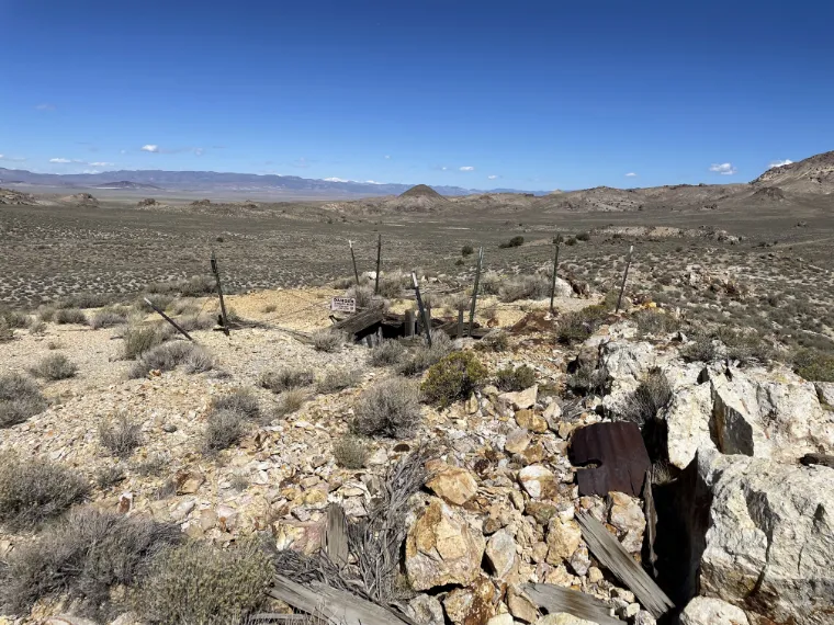
In 1922, Pacific States and KM&M joined to create the Bellehelen-Merger Mine, covering the principal workings in the southeastern end of the district. They built a 50 t per day cyanide mill and operated intermittently until 1927. Further to the northwest, the Ben Hur Mine, on the current Bellehelen Property, was put into operation. There are no documented returns from this mine, but evidence of mining remains onsite, including a hoist and several bunkhouse and service cabins.
The Ajax Mine at the northwest end of the district was developed in 1919 and last recorded production from the district was in 1935. Elsewhere throughout the district, numerous exploration shafts and adits were sunk or driven on prospects during the initial phase of exploration from 1904 to 1920. Most have no documented production, but several sites were sampled by Nevada Bureau of Mines and Geology (NBMG) geologists during the 1980’s and returned grab samples containing up to 3,000 g/t silver (Quade, 1985a). These include sites near the Ajax, Merger and Peterson mines. Production records in the area outside of the Bellehelen-Merger Mine are fragmentary. Publications in the 1980s summarize documented production from specific operations at approximately 311,000 oz silver equivalent.
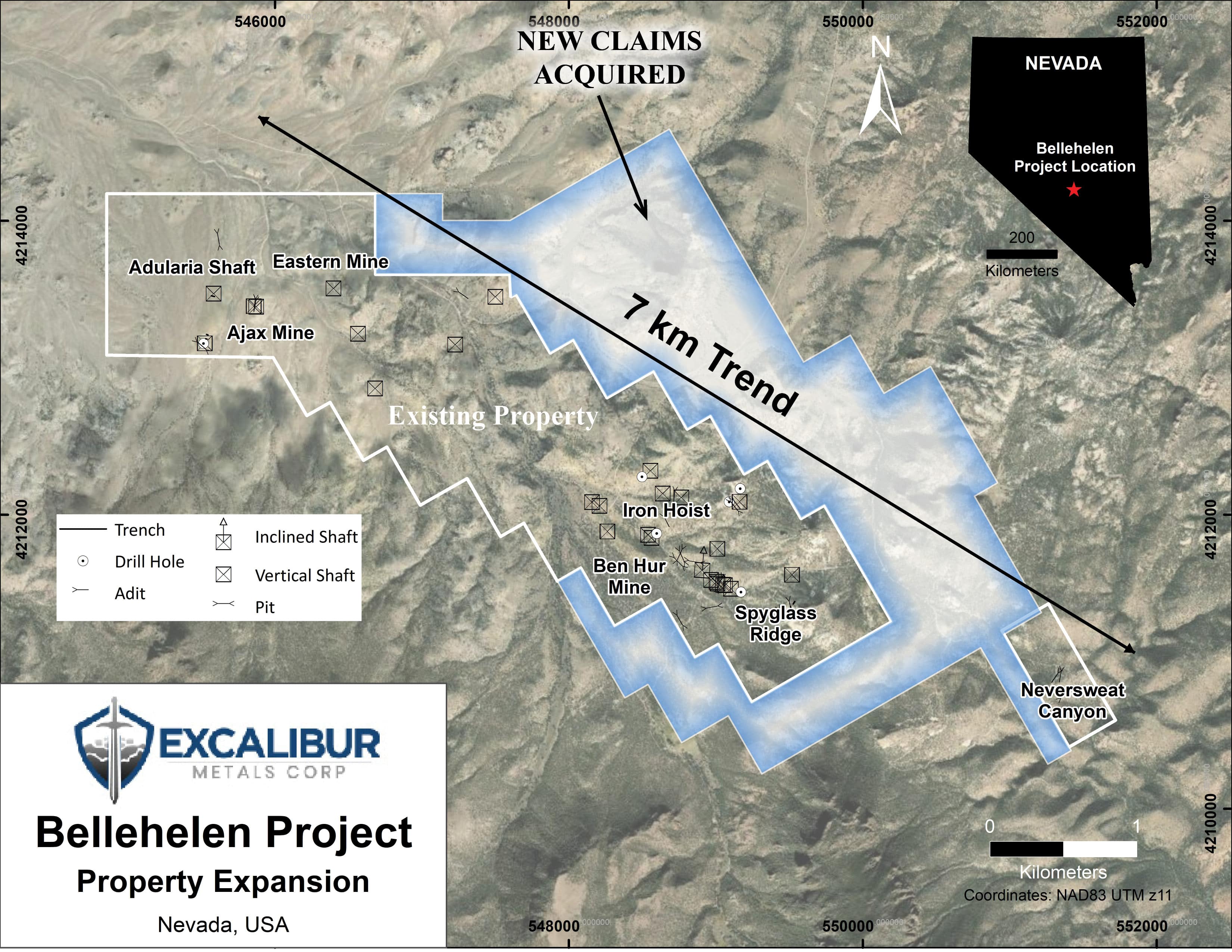
Since the 1980’s, there has been claim staking in the district by Pacific Intermont (Seabridge Gold), AngloGold, Kennecott, and Homestake Mining. Drilling was reported northwest of the Bellehelen-Merger Mine in the early 1980’s and there are drill pads northwest of the Ben Hur Mine and near the Ajax Mine on the Property. In 2013, Panarc Resources Ltd. staked the BH 1-8 claims in the Ajax Mine area. In 2016, Panarc vended the BH claims to Silver Range Resources. In October 2019, Silver Range staked the Kawich claims covering the Ben Hur Mine and surrounding showings. In September 2020, Silver Range staked the Neversweat claims covering a high-grade Ag showing near the Bellehelen-Merger Mine. Together, these non-contiguous claims make up the current Bellehelen Project. Excalibur has signed a Definitive Agreement with Silver Range granting Excalibur an option to purchase 100% of the Bellehelen Project.
The Property is an early-stage exploration property and does not have a mineral resource or mineral estimate.
The Bellehelen Project covers all but 2 of the principal showings in the Bellehelen Mining District and current data indicates the potential for a large, structurally controlled low-sulphidation precious metal system underlying a kilometre-long multi-element soil anomaly north of the Ben Hur Trend and potential for a larger disseminated gold target. There are numerous small workings on the Property and past production attesting to its mineral endowment, but the area has not been systematically explored in the modern era.
The prospective ground covers a 12 km by 2 km area that lays within a region where structurally and stratigraphically controlled (disseminated) style low-sulphidation mineralization is present.
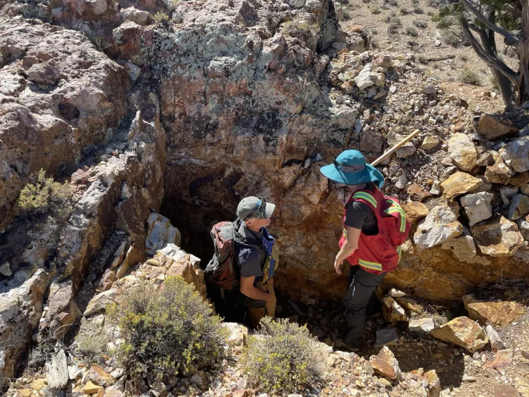
Future work is expected to consist of detailed surface geologic mapping, rehabilitation of the historical underground workings, mapping, and resampling of the existing extensive underground workings on the Property, additional soil geochemical surveys, hand and mechanized trenching, induced polarization (IP)/resistivity surveys followed by RC or diamond drilling on the best targets.


